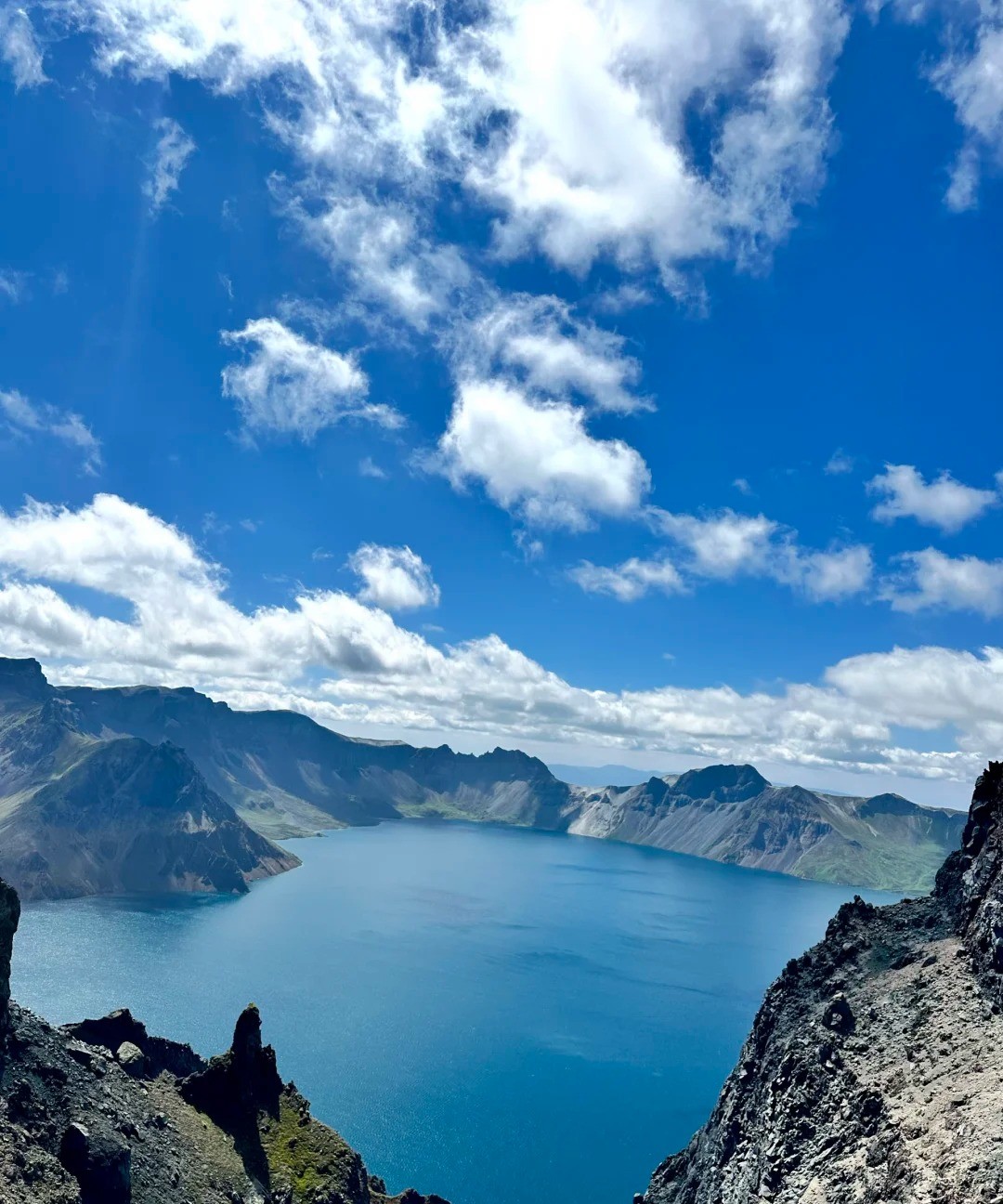
01The Yanbian Korean Aut…
The Yanbian Korean Autonomous Prefecture lies in the east of Jilin Province, at the junction of China, Russia and North Korea, and is the country's only Korean autonomous prefecture and the largest area where the Korean ethnic group (Chaoxianzu) is concentrated; long praised as a land of song and dance and a land of education, it has four distinct seasons and lovely mountains and rivers. The prefecture covers 43,300 square kilometers and has a total population of 2.072 million, of whom the Korean ethnic group (Chaoxianzu) numbers 742,000, or 35.8%; the prefecture was established on September 3, 1952, administers six cities and two counties, and has its seat at Yanji, while within its bounds are also such ancient and port cities as Dunhua, Hunchun and Tumen. Forest cover here exceeds 81.5%, and it is known as the "Changbai forest sea"; the Tumen River is China's only water route from the interior to the Sea of Japan, and Fangchuan in Hunchun, at the easternmost tip, lies just 15 kilometers from the Sea of Japan. Within the prefecture there is both a national 5A-level scenic area such as the Liudingshan Cultural Tourism Area in Dunhua, and mountain-and-border sights such as Mao'er Mountain, Fangchuan and the Tumen port; the Korean ethnic farmers' music-and-dance, the long-drum dance and the sangmo dance each have their own style, while the gayageum and pansori leave a lingering resonance. Cold buckwheat noodles (naengmyeon), tteok (pounded glutinous rice cake), blood sausage, kimchi and rice wine make up the base tones of the Yanbian table, and the swing, the seesaw and the farmers' music-and-dance write the daily life of this land of song and dance vividly. Yanbian's autumn is dyed layer on layer, snow falls on Changbai in winter, and the cool of summer and the azaleas of spring each have their own virtue. From Yanji, the mountains and waters, ports and villages in all directions lie within half a day's drive, well worth walking through carefully and worth settling down to savor slowly.
The Yanbian Korean Autonomous Prefecture sits in the east of Jilin Province, in the special position where China, Russia and North Korea meet; it is the country's only Korean autonomous prefecture and the largest area where the Korean ethnic group (Chaoxianzu) is concentrated. For many people the first impression of Yanbian is of bilingual Chinese–Korean signboards hanging side by side in the lanes, of the steam rising from a bowl of cold buckwheat noodles (naengmyeon) at the table, of Korean greetings coming one after another from the radio. The people here love to sing and dance, prize learning and respect for teachers, mind their manners, and take their days neither too fast nor too tight. Half of Yanbian's beauty lies in its mountain-and-border scenery, half in its songs, dances and everyday warmth: the deep green of the Changbai forest sea is here, and so is the chill beside the Tumen River. Only by slowing down can you taste what it really is.
First, the basic stock of this land. The prefecture covers 43,300 square kilometers and has a total population of 2.072 million, of whom 742,000 are of the Korean ethnic group, or 35.8% of the total. The land rises and falls in mountains, forest cover exceeds 81.5%, and it has long been known as the Changbai forest sea. The prefecture's border runs 768.5 kilometers in all, including 522.5 kilometers along the China–North Korea boundary and 246 kilometers along the China–Russia boundary. It has 467 rivers with a drainage area of more than 20 square kilometers, and water-power reserves of 1.41 million kilowatts. Within the prefecture there are 31 nature protection areas of various levels and kinds, covering about 1.399 million hectares in all; the Northeast China tiger and the Northeast China leopard live deep in the dense woods, and mountain, forest, river and field make up Yanbian's most unadorned ground color.
Yanbian's history runs longer than one might imagine. As early as the late Paleolithic, from tens of thousands of years to more than 10,000 years ago, ancient humans moved about and settled in the area of the Tumen River and the Buerhatong River; the Helong Dadong site is the most representative of these, and the largest open-air late-Paleolithic site yet found in Northeast Asia. Later this land came in turn under the Sushen, the Northern Woju, the Bohai Kingdom and the Eastern Xia; in Tang times the capital of the Bohai Kingdom was established in the Dunhua area. In place names, Yanji was first called Yanjigang and was refined to Yanji when administration was set up in the late Qing; in 1902 the Qing court formally established Yanji Subprefecture, and in 1913 Yanji Subprefecture became Yanji County. It was around this time too that the name "Yanbian" appeared in documents, and it finally became a formal administrative place name.
02The prefectural seat
The prefectural seat, Yanji City, is the first stop for most travelers coming to Yanbian. It is both the political, economic and cultural center of the whole prefecture and a transfer hub for journeys to Tumen, Hunchun, Longjing and Helong; the Buerhatong River runs through the city, and the parks and slow-traffic paths on its two banks string together the city's everyday life. Yanji's nights are especially lively — bilingual signboards glow all the way to the end of the street, charcoal glows red in the barbecue restaurants, and laughter never stops in the rice-wine shops. In the morning markets the stallholders greet their customers in both Korean and Chinese, and the cold-noodle shops and blood-sausage stalls set up early. From here it is quite convenient to reach every part of the prefecture by rail or by road; making Yanji your base and spreading your itinerary out in all four directions is the least troublesome arrangement.
The Mao'er Mountain National Forest Park on the city's edge is the "back garden" the people of Yanbian know best. The park lies where the southwest of Yanji City meets Longjing City, 8 kilometers from the center of the Yanji urban area, and takes its name from a hill shape that looks like a straw hat from a distance. Its main peak rises 517 meters, the park covers 1,517 hectares, and in 1992 it was rated a national forest park by the State Forestry Administration; trees grow densely within it, and forest cover reaches 76.1%. Climb slowly to the top along the gentle wooden boardwalk and the urban areas of Yanji and Longjing and the Hailan River plain spread out below — a fine spot from which to take in the scenery of the basin. Today, under the name Yanji Mao'er Mountain (Dinosaur) Cultural Tourism Area, it has become a national 4A-level scenic area, and its walking trails and service facilities are better every year; spring and summer bring green shade, autumn red leaves, and after snow in winter all is plain and clean.
The most distinctive sight in Yanbian is Fangchuan in Hunchun. The Fangchuan scenic area lies in the borderland where China, Russia and North Korea meet, linked by land to the Russian town of Khasan to the southeast and facing North Korea's Tumangang across the river to the southwest. Climb the Longhu Pavilion viewing platform and gaze far out: the Tumen River winds away below like a blue ribbon, Russia on its left bank, North Korea on its right, and beyond, where water and sky merge into one color, lies the Sea of Japan — hence the saying that you can "see three countries at a glance." Scattered about the scenic area are also such sights as the Longhu rock carvings, the Wu Dacheng Memorial Square and the Yangguanping embankment; walking them one by one gives you a rough sense of a chapter of frontier history. On a clear day the view reaches very far, and the vastness and quiet of the border can be understood only by standing there yourself.
The Tumen River flowing at the foot of Fangchuan is another thread Yanbian cannot cut loose. The river rises on the eastern slope of Changbai Mountain's main peak; its main course runs 525 kilometers in all, passing through Helong, Longjing, Tumen and Hunchun before leaving the country at Fangchuan Village in Jingxin Township of Hunchun City and emptying into the Sea of Japan. The Tumen River is China's only water route from the interior to the Sea of Japan; China's land lies on its left bank, the mountains of North Korea rise on the far side, and farther to the northeast it joins Russia's Primorsky Krai. Along the riverside road, villages, boundary stones and distant mountains appear in turn, and every step brings a new view touched with the chill and vastness peculiar to a borderland.
03Downstream along the r…
Downstream along the river lies Tumen City, whose Tumen Port is the earliest-established and longest-standing of Jilin Province's customs ports, a "hundred-year port." Tumen City covers a total area of 1,142.65 square kilometers, its boundary within the city runs 60.6 kilometers, its urban area lies 150 kilometers from the Sea of Japan, and people of the Korean ethnic group make up 53.7% of the city's population. The port is divided into rail and road channels: the rail port was first built in 1932, formally opened for trade in 1933, and the national gate of the road port stands 11 meters high and 5.5 meters wide. Standing before the gate, you can clearly make out the houses and guard posts of Namyang in North Korea on the far bank, and the feeling of being so close yet separated by the river is a subtle one. The Riguang Mountain Forest Park on the city's edge has a main peak 390.7 meters above sea level, 4.3 kilometers from the Tumen urban area, and climbing it also gives a view of both banks.
The Liudingshan Cultural Tourism Area in Dunhua is the only national 5A-level tourist attraction in the whole prefecture. The scenic area lies on the southern edge of Dunhua City and blends Buddhist culture, Bohai culture and the culture of the Qing ancestral line into one. In its hills stands the Jinding Great Buddha, the world's tallest bronze seated statue of Shakyamuni, and also the Zhengjue Temple, the world's largest nunnery; the Qing Ancestral Shrine is a center for displaying the history, culture and folk customs of the Manchu people of Changbai Mountain, and a holy place where Manchu people at home and abroad seek their roots and offer sacrifices to their ancestors; the Bohai ancient tombs, meanwhile, are among the first batch of Major Historical and Cultural Sites Protected at the National Level announced by the State Council. Even if you do not come to worship, walking among such hills and water and halls, looking at the lake light and the shadows of the woods, you will slowly quiet down.
Dunhua, where Liudingshan stands, is an old town with a long past. Dunhua covers 11,957 square kilometers and has a total population of 480,000; long known as a "thousand-year-old capital and a century-old county," it is the birthplace of the ancient Bohai kingdom and of the Qing imperial clan. In 698 AD Da Zuorong, chief of the Mohe people, established his capital here under the name Zhen, and in 713 Emperor Xuanzong of Tang enfeoffed him as Prince of Bohai, from which the Bohai Kingdom took its rise. In Qing times the area was long closed to settlement; in 1881 administration and a county were established under the name Dunhua, and in 1985 the county was made a city. Dunhua's forest cover reaches 84.9%; outside the town the main peak of Laobaishan rises 1,696 meters, the Yanming Lake area averages 263 meters above sea level, and Yanming Lake Town covers 1,508 square kilometers, its lakes and marshes and wetlands joining into one stretch that is a haven for migratory birds and waterfowl.
Farther east lies the port city of Hunchun. Hunchun sits on the lower reaches of the Tumen River and is the country's only border gateway city standing at the junction of China, Russia and North Korea — linked to three countries and open to five. Forest cover here is above 85%, ethnic minorities make up 47% of the city's total population, the manners are plain and honest, and on the streets you often meet Russian traders and travelers. Hunchun is the hub of Yanbian's cross-border tourism: from here you can take China–North Korea, China–Russia and China–Russia–North Korea loop routes, and not far across the border lie foreign ports and cities, so that border trade and exotic flavor interweave here with particular vividness.
04To the west
To the west, Longjing and Helong each have a flavor of their own. Longjing takes its place name from an old well spring; in the center of the city, the origin well spring in Julong Park leans close to a century-old willow, and on its stone tablet are carved the words "the well spring where the place name Longjing began." Longjing also has the former site of a Japanese consulate general, now open to visitors as hard evidence of Japan's invasion of China. Helong wins by time: the Dadong site within its bounds pushes the history of civilization on this land back to the Paleolithic, the Xianjingtai area has quiet woods, and Guangdong Village folds green rice and Korean ethnic customs into country life, so that every village and every view breathes a slow passage of time.
In Wangqing County to the north, the hills and waters are just as open. The Mantianxing scenic area centers on an artificial lake formed by the barrage of the Mantaicheng power station; it covers 56.7 square kilometers in all, of which the lake surface is 10.5 square kilometers and the lake runs 18.7 kilometers long, with peninsulas and woodland alternating upon the water — a boat trip here is the pleasantest of outings. The Jilin Lanjia Grand Canyon National Forest Park has a planned area of 10,927 hectares and forest cover of 97.9%, known for being primeval, natural and wondrous, a quiet spot deep in the dense woods. The Pingfeng Mountain Park in the county town is a good place for residents to relax, its pavilions, walking trails and wooden boardwalks scattered through it.
Antu County is the first county below Changbai Mountain, and both its scenery and its produce carry the breath of the mountains. The Changbai Mountain Grand Guandong Cultural Park in the county stands in Dongqing Village of Yongqing Township; the village has a history of more than a thousand years and once served as the seat of a Bohai prefecture, and the park recreates Shamanist culture and scenes from the life of the early inhabitants. The Xueshanfeihu Lake in Liangjiang Town is an artificial lake on the upper reaches of the second Songhua River, its winter snowscape and summer blue water each with its own charm. Antu is also a well-known producer of mineral water in China, with the title "hometown of Chinese mineral water"; guarding the clear springs of Changbai Mountain, its days are fresh and crisp too.
Yanbian's four seasons are also a journey you can settle down into. In summer the prefecture is cool, and mornings and evenings still call for a light jacket; it is a well-known retreat from the heat, where forest wellness, hot-spring holidays and study tours are growing steadily more developed. In autumn the five-colored hills are dyed layer on layer, and the woods are full of gold and crimson; in winter snow falls on the border town, and the pairing of skiing and hot springs is especially popular. In recent years Yanbian has also built a smart-tourism platform, packing information on food, lodging, travel and sightseeing into a phone, so that travelers can move more at ease through this vast stretch of mountain forest and are more willing to stay a few days longer.
05What moves people most…
What moves people most in Yanbian, though, is the culture of the Korean ethnic group. The sangmo dance is the most technically demanding of the traditional dances here: the dancer shakes the sangmo hat on his head, its long streamers whirling like wind — the longest streamer reaching 12 meters, the shortest still 1.5 meters — and in 2006 the Yanbian Korean sangmo dance was added to the national list of intangible cultural heritage. The long-drum dance grew out of the farmers' music-and-dance; in 2008 the long-drum dance and the vertical bamboo flute were together added to the national list. In 2009 the Yanbian Korean farmers' music-and-dance was inscribed on the World Intangible Cultural Heritage list. Besides these, the seesaw, the swing, the gayageum, the water-carrying dance and pansori each have their own line of transmission; at festivals, once the long drum sounds and the skirts spin up, the whole village comes alive.
Where there are songs and dances, good food is never far behind. On a Yanbian table, cold buckwheat noodles (naengmyeon) are the star you cannot get around: buckwheat noodles steeped in a sweet-and-sour broth flecked with ice, a single mouthful cooling you to the core. Tteok (pounded glutinous rice cake), blood sausage and kimchi are the home-style flavors of Korean ethnic households — rice cakes dipped in soybean flour, kimchi sour and hot and appetizing, moreish with every bite. If you want a drink, the rice wine served in shallow bowls is faintly sparkling, a little sour beneath the sweet, and goes best with charcoal-grilled meat. In recent years Yanbian's flavors have long been famed far and wide, and in the towns large and small across the prefecture you can come upon an authentic bite anywhere you go; from early morning to late night there is always something warm waiting for the traveler.
The best places to taste these flavors are the Korean ethnic folk villages. The Hongqi Korean ethnic folk village in Antu styles itself "China's first Korean ethnic village" and still keeps the old-style Korean ethnic dwellings and food customs; Guangdong Village in Helong sits on the bank of the Hailan River, known for its green rice, where visitors can go into the fields to watch the farming and indoors to taste a home banquet; and the Chunxing ancient Korean ethnic village in Yilan Town of Yanji City joins dwelling visits, dining and folk-experience activities into one. In these villages the dress, wedding customs and daily life of the Korean ethnic group remain as vivid as life; stay a night and you understand its ease all the better.
Yanbian is also a land of red heritage. The Yanbian Museum in Yanji was founded in 1960: a comprehensive museum combining local history with the ethnic character of the Korean ethnic group, it has 7,200 square meters of exhibition space, and its permanent displays include the Korean ethnic folk-custom display, the display of the history of Korean ethnic revolutionary struggle and the display of artifacts unearthed in Yanbian. In addition, Dunhua has the Chen Hanzhang Martyrs' Cemetery, Wangqing has the Xiaowangqing revolutionary base area, Hunchun has the Dahuanggou red tour, and Longjing has the former site of the Japanese consulate general — strung point by point, they make a history lesson on the march along the border.
06Getting to Yanbian tod…
Getting to Yanbian today is no longer difficult. Yanji Chaoyangchuan International Airport operates routes to Beijing, Shanghai, Guangzhou and Shenzhen, as well as to Seoul in South Korea, Pyongyang in North Korea and Vladivostok in Russia; after Yanbian entered the high-speed rail era in 2015, the Jilin–Hunchun dedicated passenger railway linked Yanji with Changchun and other places into one line; within the prefecture, trunk lines such as the Changchun–Tumen railway, the Northeast China eastern railway corridor and the Changchun–Hunchun expressway run across from east to west. Long-distance buses within the prefecture are frequent, and it is easy to get from Yanji to Tumen, Hunchun and Longjing; take Yanji as the center of the circle, and most of the scenery in all four directions lies within half a day's drive, making travel very relaxed.
When you plan your itinerary, three or four days is a fairly unhurried rhythm. On the first day settle into Yanji and stroll along both banks of the Buerhatong River, and in the evening eat a barbecue meal and drink a bowl of rice wine; early on the second day head for Hunchun to see Fangchuan's "three countries at a glance," stopping on the way at the Tumen port; on the third day turn to Liudingshan in Dunhua to take in Bohai and Buddhist culture, and that night stay in Dunhua or return to Yanji; if you have one more day, climb Mao'er Mountain or find a Korean ethnic folk village to while away the time slowly. Yanbian has four distinct seasons — cool and pleasant in summer, hills covered in red leaves in autumn, and in winter a time to enjoy the snow and soak in hot springs, with summer and autumn the most comfortable of all. Each year Yanbian receives 45.11 million visitors and takes in 74.6 billion yuan in tourism revenue; the liveliness of this border town has long been understood by more and more people.